Building Longstreet’s Assault
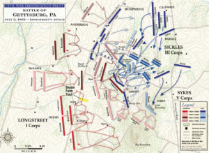 Before undertaking Building Waterloo, my first attempt at a contour battle board involved a Gettysburg project covering the Confederate assault the afternoon of July 2nd on the southern end of the Union line. The attack including the divisions of Hood, McLaws and Anderson on the Round Tops, Devil’s Den, the Peach Orchard, Wheatfield and the southern portion of Cemetary Ridge.
At the time, I was looking for an excuse to get back into 15mm ACW, which happened to be my first venture into miniatures decades ago. I wanted to do an historical OOB and an engagement that would fit on a moderate sized table, something like 6′ x 8′. After a bit of studying various engagements, mainly using a rule to scale a bunch of battlefields, I realized I could fit most of Longstreet’s attack on the right sized area. The only thing I lose would be the northern two brigades of Anderson’s attack, and if I got ambitious, I could always add that later by extending things north (and maybe do Pickett’s Charge one day).
Once I decided up Longstreet’s Assault for the project, the next question was scale. I was looking at Johnny Reb III as a basic scale, but a little fudging was necessary to get everything to fit. In the end, I had to go with closer to 1″ = 65 yards (as opposed to 1″ = 50 yards for JRIII), but no one knows but me.
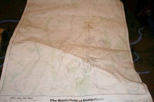
Friends of Gettysburg Map
Next I had to find a good source map. I found exactly what I was looking for from the Friends of Gettysburg in a series of maps of the battle that had been commissioned and overseen by Thomas Desjardin. These had all the contours I needed and all the major terrain features.
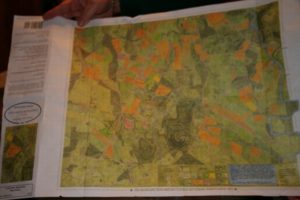
McElfresh Map
I then stumbled on another source map from McElfresh which had information on the type of crops in each field. Between the two, I was set.
Next I made a trip to Kinko to blow up the map to scale. I realized that I could not follow the contours without having the map the exact scale of my battle board.
At some point along the way, I had to determine what to make each level of the contour out of. I quickly realized that each contour level could not be too high, otherwise the overall board will be too tall and the slopes too steep for figure stands to remain still without sliding or falling over.
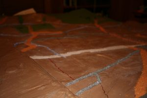
Base board completed. Starting to flock and place roads.
Vertical scale is misleading. If you want a true to scale vertical scale, you will have almost no elevation.
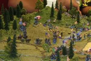
Looking up Plum Run at Little and Big Round Top.
Little Round Top is about 150 feet higher than the Plum Run valley. At my ground scale of 1″ = 55 yards, Little Round Top would only be 1 1/2 inches high, something that would not be very imposing to say the least. Thus I realized I need to exaggerate vertical scale. It just happened that I’d realized 1/4 fiber board would be easy to work with in building my layer cake board. So after all was said and done, my Little Round Top is going to look like much more the significant terrain feature it actual was.
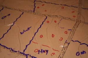
Labeling fields and fences/walls
In picking out the 1/4″ fiber board, I realized that I would have to make each section of my battle board the same size as the fiber board, which was 30″ x 40″. I build a square to the scale of the Desjardin map that showed me how much 4 fiber boards would cover (60×80) and moved it around until I had as much of the area as I needed (this is where I realized I need to fudge it out to 1in:55/60yds).
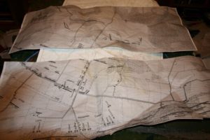
Blown up and cut into sections, the Desjardin Map

McElfresh’s map
Having blow up Desjardin’s map to the correct scale, I pulled out some carbon paper and started tracing each elevation contour onto a separate piece of fiber board. If you’ve read my Building Waterloo page, you know how that works. The rest of the project went exactly the same as Building Waterloo. Cut out the contours, stack and glue them together, put on the LIQUITEX Flexible Modelling Paste, spray paint, grout the roads, flock the woods and then fields. The main difference with the Longstreet map was I decided to put in the fence lines and stone walls. I quickly realized that 15mm fences were just too big, so I used 10mm fences and walls from GHQ. They looked perfect. I also used 10mm buildings, as the 15mm looked too out of scale with the map and took up too much room.
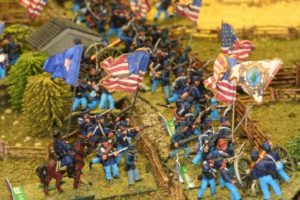
McLaws advancing on the Peach Orchard
I also used McElfresh’s map to put in different color flock for different field types. I realize that in early July most things would be greener than I have them, but I wanted to show the difference. I put on a lot of dark stain to muddy things up. I also sprayed everything with DullCote when I was done just to seal it all in and make it a bit water resistant. I also used Woodland Scenics water (an outstanding product) to make the streams look wet, etc.
So that’s about it. We game using Carnage & Glory II, but you can play Johnny Reb and any other regimental system. As with Waterloo, I had particular enjoyment seeing that once everything was deployed using my
chosen basing frontage, each regiment laid out just like it looks on all the deployment maps. It just all fit perfect.

Looking from Warfield Ridge to Big Round Top
So that’s about it. We game using Carnage & Glory II, but you can play Johnny Reb and any other regimental system. As with Waterloo, I had particular enjoyment seeing that once everything was deployed using my chosen basing frontage, each regiment laid out just like it looks on all the deployment maps. It just all fit perfect.
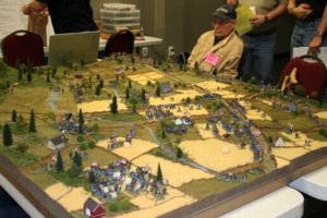
Ready to start the game
I pulled out a ruler the other day and determined that with two more 30×40 sections I could take things all the way to Cemetery Hill. Maybe one day.


Comments
Building Longstreet’s Assault — No Comments
HTML tags allowed in your comment: <a href="" title=""> <abbr title=""> <acronym title=""> <b> <blockquote cite=""> <cite> <code> <del datetime=""> <em> <i> <q cite=""> <s> <strike> <strong>